Nepal 2013
Everest Base Camp Trek
Ascent to Everest Base Camp
October 21 to October 27
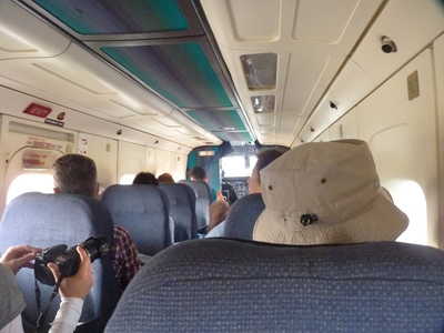
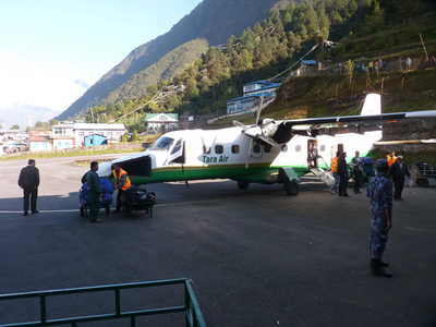
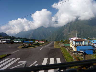
An exciting part of our trek was getting to and from the area. The shortest treks to Everest involve flying to Lukla. Lukla has a small airport at 9318 feet elevation. The runway is short, and is on a slope, with the lower end over a cliff down into the valley, and the higher end ending at a steep upslope. There is little margin for error and this airport is considered one of the most dangerous in the world. Low clouds also frequently prevent flights here, most of the flights are in the morning when it tends to be clearer. But there are days when no planes fly here, even during the trekking season when the weather is typically better. Our flight was scheduled for 7:45am so we had an early start with breakfast and a ride to the airport. Weather was good that day and our flight actually left a few minutes ahead of schedule! On landing, the plane turned around quickly with us unloaded and a new group loaded up in the space of about 10 minutes, then the plane was off to head back to Kathmandu. We headed to a local guest house to get our baggage situated (divided between what we would carry versus the porters) before the trek that day. Most people start trekking right after flying in, as the trail drops into a valley and it makes it easier to acclimate if you spend the first night a bit lower. We stayed at Phakding (8563 ft) that first night.
Acclimation is critical on this trek to avoid altitude sickness. Our itinerary had "rest" days built in for this purpose. A rest day didn't mean that you necessarily rested that day, it just meant that you stayed in the same village two nights in a row. Acclimation is helped by going even higher during the rest day, then coming back down to sleep. We had rest days in Namche Bazar (11,286 ft) and in Dingboche (14,469 ft).
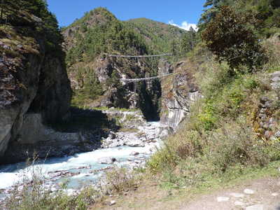
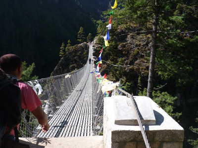
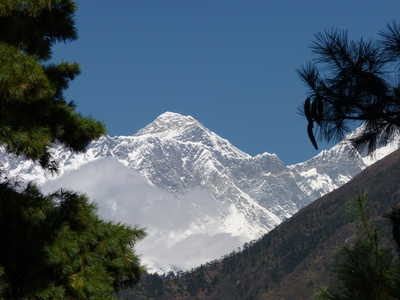
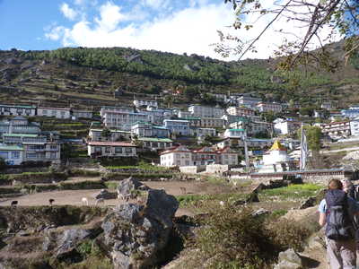
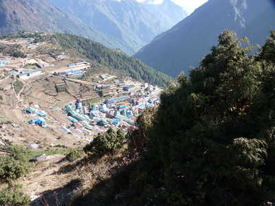
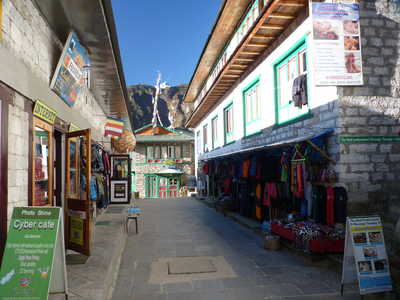
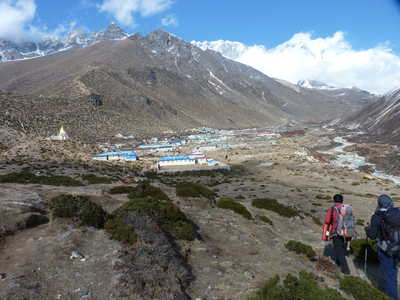
Our second day we headed up to Namche Bazar, which is the largest village in the region. It is built on a slope high above the river valley. A suspension bridge high above the river is crossed on the way to Namche, then an uphill climb brings you to the first view of Everest. On our rest day, we hiked above Namche to Syangboche and then to an awesome viewpoint of Everest, visiting Khumjung's monestary and school on the way back to Namche.
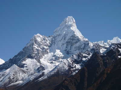
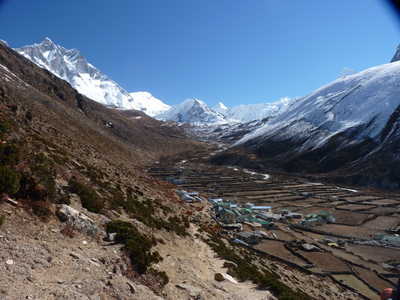
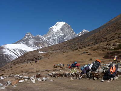
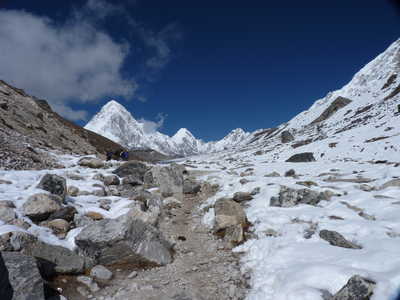
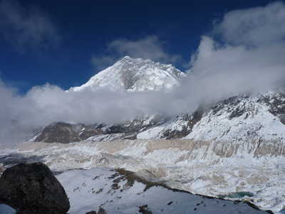
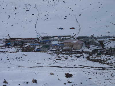
Day 4 had us trekking to Tengboche (12,664 ft), perched high on a ridge. This village has the area's largest Buddhist monestary, which we visited the next morning. On day 5 we continued on to Dingboche. On our rest day here we climbed the slope north of the village to some great viewpoints of Lhotse and Ama Dablam. Day 7 we continued our uphill climb to Lobuche (16,109 ft). We were well above the treeline and also crossed above the snow line, with snow covering most of the ground, remnants of the storms I endured on the Annapurna Circuit. Lobuche was fogged in with low clouds, but we climbed the lateral moraine to the east of the village for a view of the massive Khumbu Glacier which starts just south of Everest. This short climb also aided in our acclimation.
|
Flight to Lukla, runway in Lukla
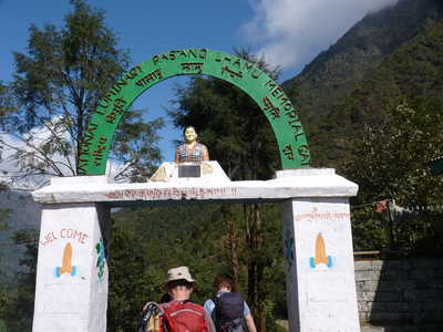
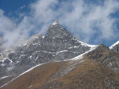
Arch where trail enters Lukla, Kusum Kanguru (20,889 ft), Thamserku (21,713 ft)
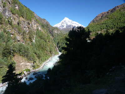
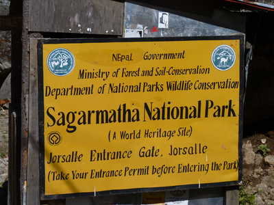
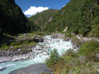
Khumbi Yul Lha (18,914 ft), national park entrance sign, Dudh Koshi river
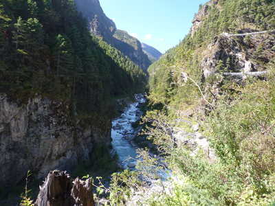
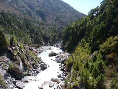
High suspension bridges (we went over the higher one), river canyon, and approaching the high bridge
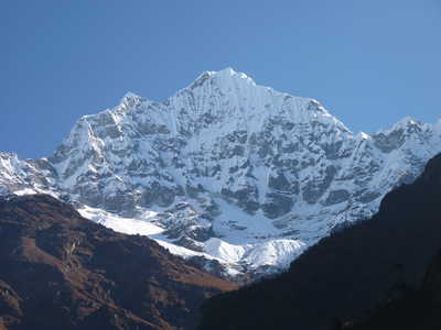
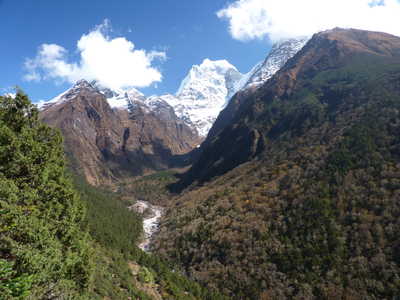
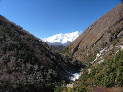
First view of Mt. Everest (29,028 ft), Namche Bazar, Nupla (19,308 ft) and Shar (Tartika) (20,295 ft)
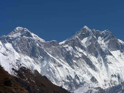
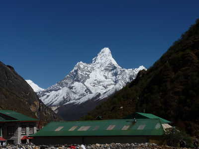
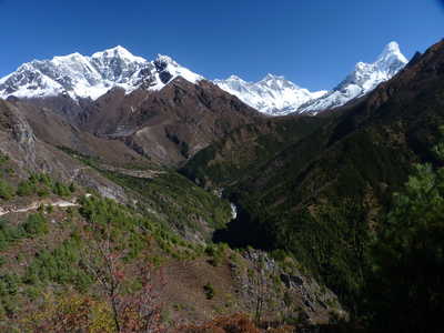
Ama Dablam (22,493 ft), Everest and Lhotse (27,890 ft), all three mountains in one wide view
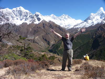
Happy to be here!, village of Khumjung, Ama Dablam over Khumjung
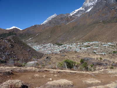
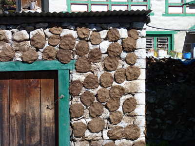
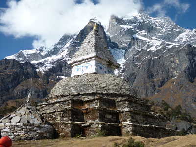
Yak dung drying on the wall (used for fuel), Buddhist stupa, Namche on the hillside below
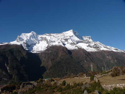
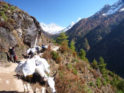
Narrow street in Namche, Yak train on trail, trail terracing with Everest, Lhotse, and Ama Dablam above
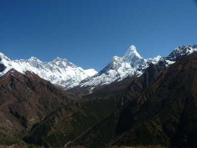
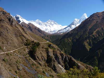
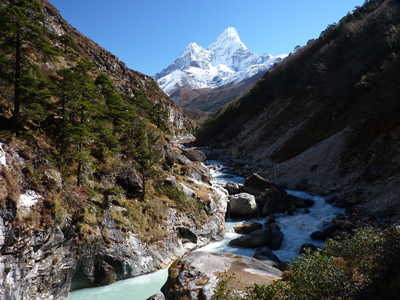
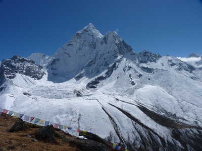
Tobuche (21,309 ft), Everest, Lhotse, Ama Dablam, river canyon, and Kangtega (22,254 ft) over river valley
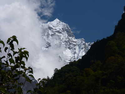
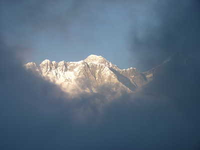
Everest
through a window in the clouds from Tengboche (from bedroom window!),
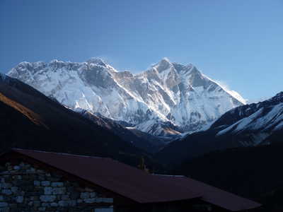
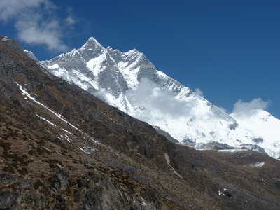
Everest and Lhotse in the morning, Ama Dablam over river canyon
Looking
back at Nupla and Shar, forward view with Lhotse and trail to Dingboche
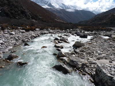
on center hill, Lobuche Khola river from the bridge
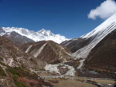
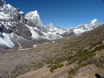
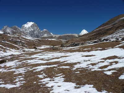
Nameless peak on the Nuptse ridge, Dingboche stretching ahead, Lhotse on far left over Dingboche
View east from above Dingboche: Island Peak (Imja Tse) (20,305 ft) is left of center, Cholatse (20,784 ft) and Lobuche East (20,075 ft), Ama Dablam (different from this side!)
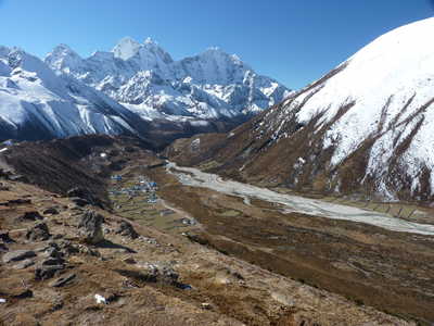
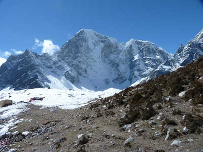
Lhotse, Kangtega and Thamserku over Pheriche (village), Lobuche East (peak) looms above
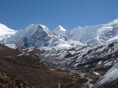
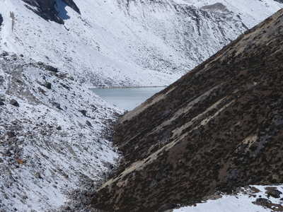
Chola Tsho (lake), Lobuche East and Pumo Ri (23,507 ft) just peeking over, Tobuche from Dughla village
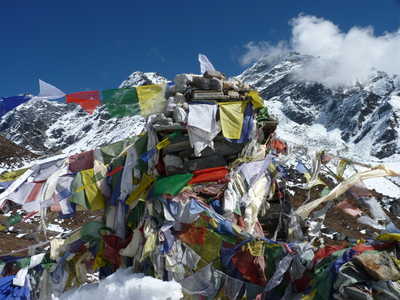
Monument
and prayer flags at Everest memorial site, Pumo Ri, Lingtren (22,024
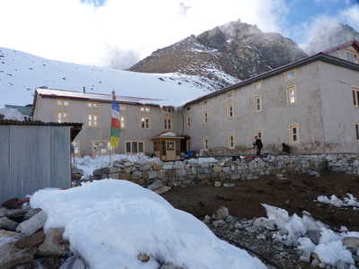
ft), and Khumbutse (21,781 ft) loom ahead, guest house in Lobuche
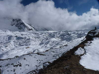
Khumbu Glacier looking downstream, Nuptse (25,800 ft) looms over Khumbu Glacier, Lobuche village from the moraine
|