Cartridge Pass and Muro Blanco 2006
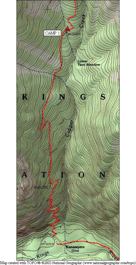
Roads End to Tent Meadow
Thursday, August 17, 2006
Index <<Previous Next>>
|
Different than most of our trips, we started hiking right after the drive down. We had to leave early to make the 6-hour drive to Roads End before the wilderness permit station closed for the day. We wanted to split the initial 6000 feet of uphill over three days, so the afternoon start worked well the first day. An all on-trail 4-mile hike up 2800 feet brought us to the first legal campsite at Tent Meadow, at 7800 feet elevation. Temperatures were moderate, for which we were lucky as temperatures in the afternoon on this south-facing climb can get quite hot, and there are plenty of stretches without much shade.
Tent Meadow is not much of a meadow (neither Lower nor Upper). Apparently the name comes from a rock that is shaped like a tent… we didn’t see this rock.
Journal Entry: Drove down to Roads End in Kings Canyon, got there around 1:10pm—got permit and on the trail by 2:30. Uphill, uphill, uphill to camp at Lower Tent Meadow, arrived here around 6pm. Nobody else is here. Saw two deer that hung around camp for a while. Tomorrow’s goal is Grouse Lake. |
|
|
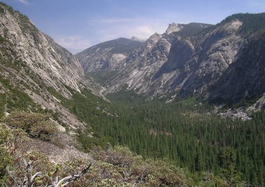
The view into Kings Canyon from Copper Creek Trail |
|
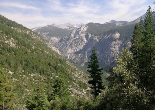
The view into Kings Canyon from higher |