Mt. Langley and Mt. Whitney 2007
Mount Langley Summit
Saturday, August 18, 2007
Index <<Previous Next>>
|
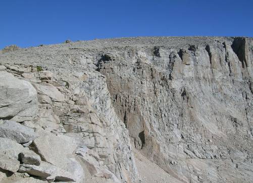
The most popular route up Mt. Langley by far is the one we took to get up there. Some even do it as a long day hike from the same trailhead we started at! This is supposed to be a class 1 route, but we ran into some class 2 sections that were short. Since it was a weekend, there were quite a few people doing the summit. Everyone but us had either dropped their packs at Army Pass or left them in camp. We were hauling our packs as we were taking a different route down. Very nice views from the summit, although smoke was fairly heavy to the east. We were on our own on our descent route, as everyone else went back the same way we came. We followed the southwest ridge down a mostly sandy slope with some small rocks mixed in. Sandy slopes going down aren’t too bad as you can kind of “ski”, although I was wishing I’d brought gaiters as my boots filled with sand. Lots of footprints and droppings in this area that we believe were from bighorn sheep, although we unfortunately didn’t see any sheep! We aimed for the flat area just north of The Major General. Quite and unimpressive pile of rocks from this side, I hope it’s more impressive towering above the lakes to the south. The most difficult part of the descent was from here down to the bottom of the valley, but we took our time and soon we were all the way down. Journal Entry: Very long day today. Got an early start just after 8am. Army Pass was straightforward, most of the old trail was still there. Got to the top and headed for Mt. Langley, again on a pretty good trail until the bottom of the last big uphill was reached. Got to the summit around 1pm, along with around 20 others. Views were great, although smoke was obscuring the Owens Valley. Started down around 2pm, our route to Miter Basin was mostly slippery scree, ok on the downhill. After the flat area north of the Major General, route became more difficult, over scree, talus, and slabs. Decided to camp by the creek below Sky Blue Lake due to our exhaustion. Got here around 5pm. Last night the stars were obscured by smoke, but it cleared by morning. Right now we can see smoke to the south. Sky above was clear with no clouds all day. |
|
|
|
Lake 11171 and 11187 from halfway up Army Pass |
The top of Army Pass |
|
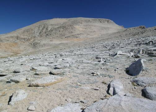
Mt. Langley looms ahead |
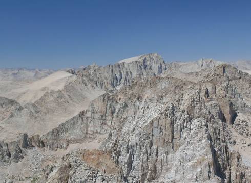
Mt. Whitney is the high point on the ridge from the summit of Mt. Langley |
|
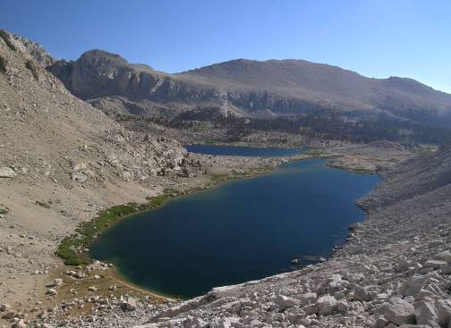
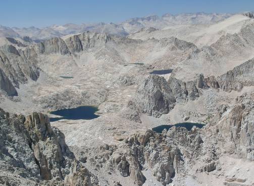
Looking down into Miter Basin, our next destination Sky Blue Lake is the large lake on the left, Iridescent Lake is lower right The Miter is right behind Iridescent Lake |
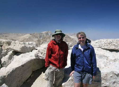
Ron and Steve on Mt. Langley Mt. Whitney is just to the left of Ron’s head |
|
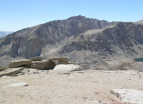
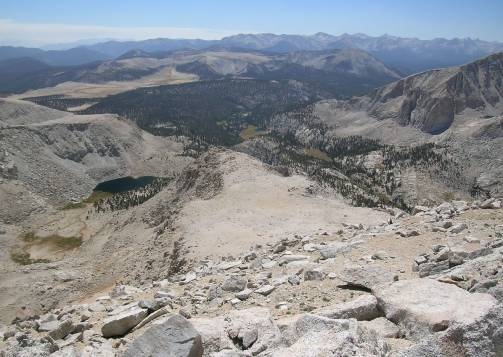
Our route down, looking south The Major General is slightly left of center, Lake 11195 to its left |
The Major General looking pretty unimpressive from here |
|
I called this “Stonehenge” (having just seen the real one in July) Joe Devel Peak looms above |
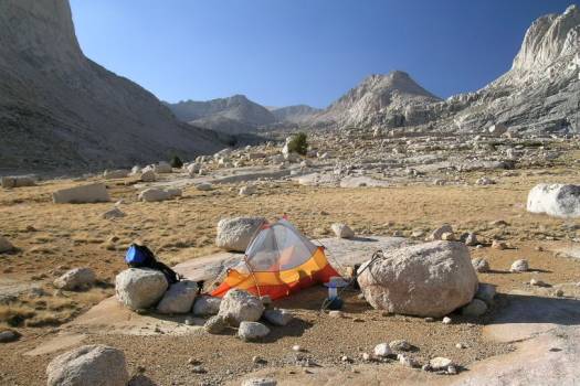
Campsite in Miter Basin below Sky Blue Lake The Miter is on the far right |