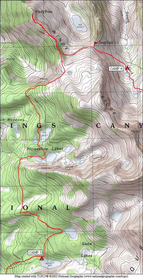
Cartridge Pass and Muro Blanco 2006
State Lakes to South Fork Cartridge Creek
Sunday, August 20, 2006
Index <<Previous Next>>
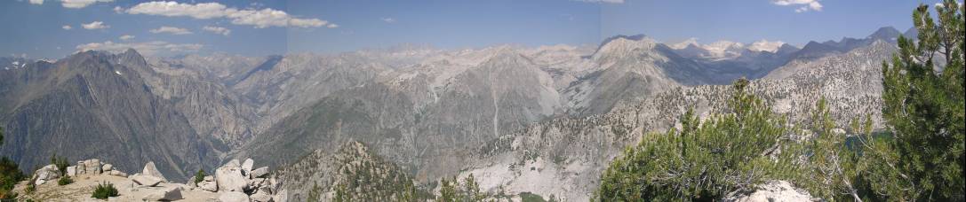
View from Windy Point—click on the picture for a larger, labeled version of the above panorama!
|
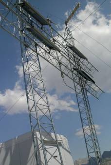
Despite camping near the trail, and being on a trail until Horseshoe Lakes, we saw nobody at all today. After hiking most of the way to Gray Pass, Ron had it in his head that we should visit Windy Point, which is known for its great view into the canyon of the Middle Fork Kings River. We didn’t want to drop our packs and risk not being able to find them (although that could have been solved with a GPS waypoint) or risk animals getting into them, so we carried them the one mile or so each way out to Windy Point. Windy Point has some sort of antenna structure, guessing a repeater for the radios used in the backcountry. The views from here did not disappoint! We treated this as our “peak” for the trip, but it did make for a much longer day than we had planned. Despite this, we still made it to our planned camp in the remote valley of the South Fork of Cartridge Creek. Gray Pass is a strange pass, with the approach from the west hitting higher ground, then dropping, then rising slightly to the pass. The views from Gray Pass extended over to White Pass, but much of the valley we were to drop into was obscured initially.
Journal Entry: More trail than expected today. Followed to the upper State Lake, then another trail not on the map to Horseshoe Lakes. Left the trail to head north up a ridge overlooking Windy Canyon. We decided to take a side trip (with packs) to Windy Point, a view point with some repeater antennas on it, but with grand views of the middle fork canyon and Cartridge Creek. Was hazy to the west. Then we headed back, and over Gray Pass, then down to the S. Fork Cartridge Creek valley where we’re camped at a small lake. Got here around 5pm, exhausted! |
|
|
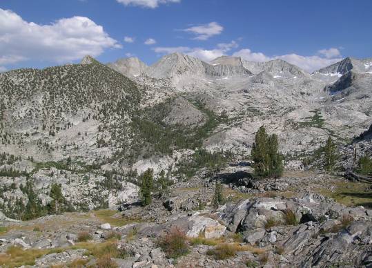
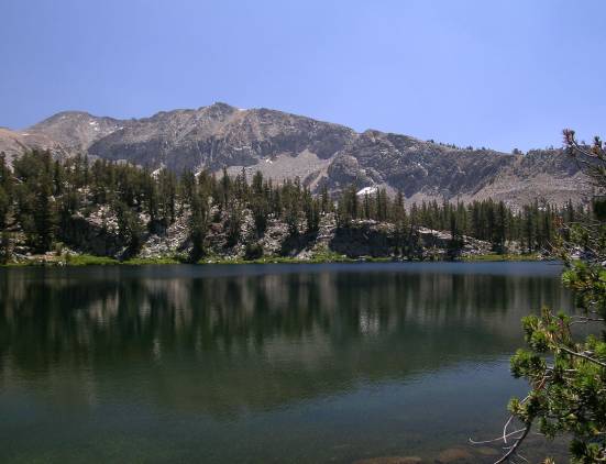
Largest of the northern Horseshoe Lakes |
|
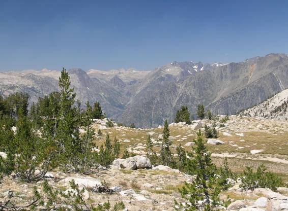
View toward the Middle Fork Kings River gorge from north of Horseshoe Lakes |
|
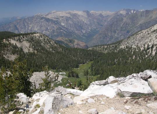
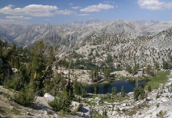
Windy Canyon and the Middle Fork gorge The valley extending back on the other side is Goddard Creek |
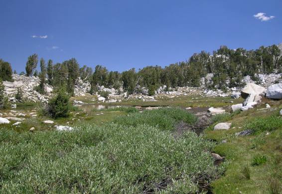
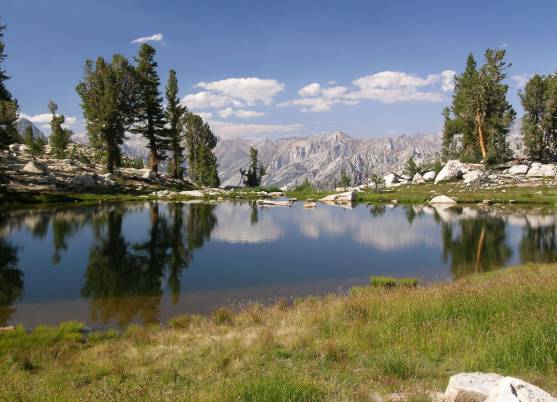
small lake just above 11,000 feet, southwest of Gray Pass |
|
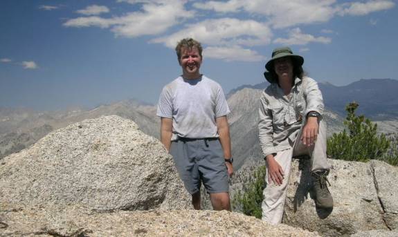
Steve and Ron at Windy Point |
Antennas at Windy Point |
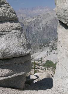
Palisades peek through a notch Near Windy Point |
|
small pond just west of Gray Pass and Lake 10,236 behind it |
small pond just west of Gray Pass |
|
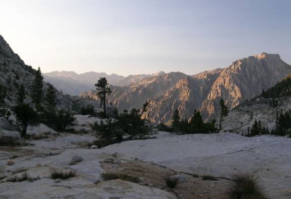
Looking down into S. Fork Cartridge Creek valley from Gray Pass |
View down-valley from our campsite near sunset |