Mt. Tyndall and Wallace Basin 2009
Upper Wright Lake to Willimason Bowl
Thursday, August 27, 2009
Index <<Previous Next>>
|
Tyndall Col was the least solid route on the trip. Although it was labeled as class 2, we had seen difficult class 2 before and this one looked pretty steep on first sight. Once on it, however, it wasn’t too bad on the west side, just a lot of steep climbing. The east side had a section of steep chute made slippery by loose rock. We used a rope to lower both of our packs down so we could climb down without a pack challenging our balance. We had an alternate route that would have gone back west and over a saddle to the Shepherd Pass trail, but we did want to go through Williamson Bowl and were successful in that goal! Unfortunately we didn’t see any bighorn sheep (although there was evidence of bighorn sheep!). This was our highest camp of the trip, at about 12300 feet elevation.
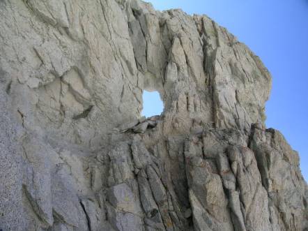
Journal Entry: Another tough day with perfect weather. Started our climb to Tyndall Col around 9:30. First part was easy—upper part steeper chutes. I took an alternate chute which resulted in me climbing through a “window” in the rock. Reached the pass at noon. Other side dicier than we had hoped—upper part was a steep chute—we lowered our packs with a rope. Got less steep after that but lots of loose talus with some “scree skiing” sections. Reached our lake in Williamson Bowl around 3:30, found campsite above the lake near a moraine. Tomorrow should be easier, with a climb to Shepherd Pass where we meet the trail. |
|
|
upper Wright Lake in the morning |
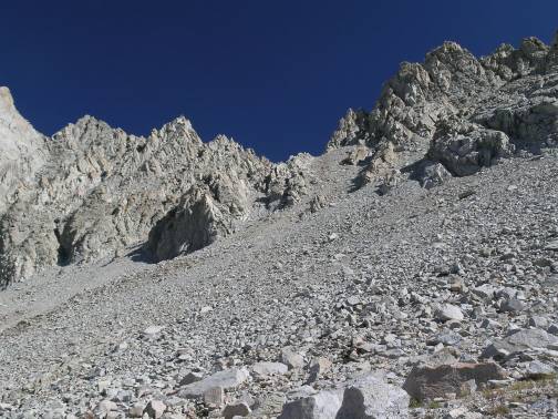
Tyndall Col looming above us |
|
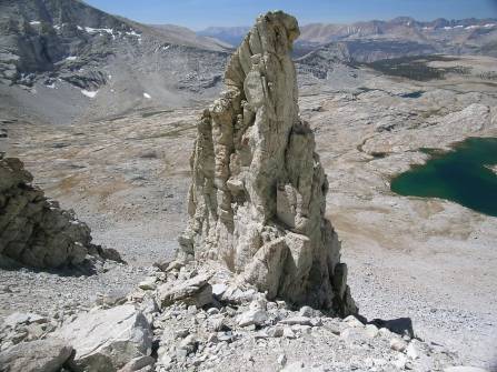
a spire near the col |
window in the rock Steve climbed through |
|
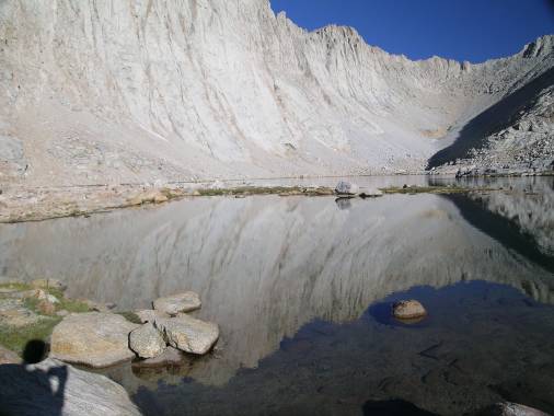
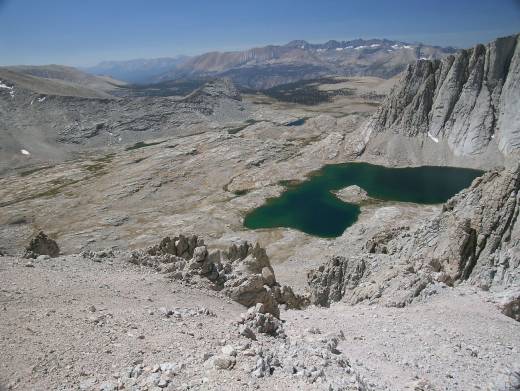
upper Wright Lake and Kaweahs from Tyndall Col |
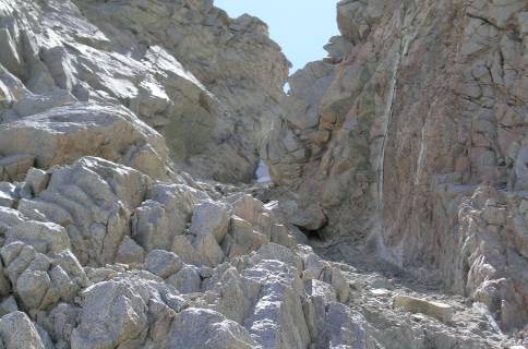
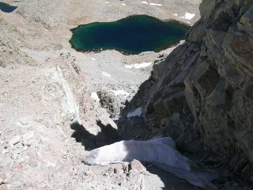
looking down the chute on the east side of the col |
|
looking back up at the chute near the top of the east side |
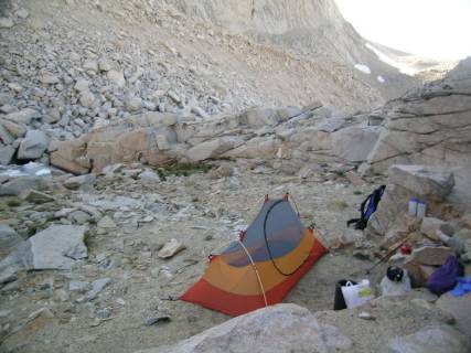
campsite in Williamson Bowl (note the icy pond on left side of picture) |