Big Pine Lakes 2021
August 23 – Big Pine Lakes Trailhead to First LakeAugust 24 – First Lake to Sixth Lake
August 25 – Cloudripper summit
August 26 – Sixth Lake to Sam Mack Meadow
August 27 – Palisade Glacier
August 28 – Sam Mack Meadow to Second Lake
August 29 – Second Lake to Contact Pass pond
August 30 – Contact Pass pond to Brainerd Lake
August 31 – Brainerd Lake to Big Pine Lakes Trailhead
After all these years
backpacking in the Sierra, we had never been to the Big Pine Lakes
basin. We had seen the area from above on our climb of Mt. Sill
in 1998. It was finally time for a proper visit of the area.
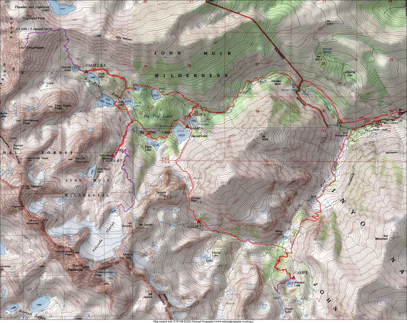
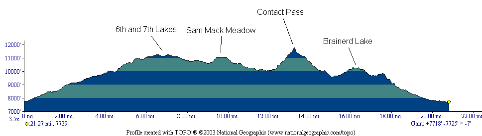
The entire trip was on the east side of the Sierra Crest. We included a climb of 13,525-foot Cloudripper and a visit to the Palisade Glacier, the largest glacier in the Sierra. We then crossed Contact Pass from the North Fork Big Pine Creek to the South Fork drainage. The trip featured lots of days with fairly low mileage as this was not a huge area to cover on a 9-day trip. Toughest days were the climb of Cloudripper and the crossing of Contact Pass (11,760 ft).
Many
of the lakes in this area have a turquoise color caused by silt in the
glacier melt water. Weather was good, with no rain at all and
only minimal smoke from distant wildfires (there were no fires
nearby). The first few days we had wind, with the most severe
being during the climb of Cloudripper where there were gale-force winds
on the saddle between Seventh Lake and Thunder and Lightning
Lake! Nights never got too cold.
We had quite a few animal encounters, with pikas being heard at numerous locations, posing for pictures at Sam Mack Meadow and Brainerd Lake. Sam Mack Meadow had a particular variety of animals, with tadpoles and frogs in ponds, pikas and chipmunks, and a sooty grouse wandering the meadow in the morning of the Palisade Glacier hike.
Note
that the elevation profile above does not include the three day hikes
we did (Cloudripper, Palisade Glacier, and Finger Lake). On the
map below, the red route is backpacking, and the purple routes are the
day hikes.
Go here to see all of the pictures with the same captions at Google Photos.