Kaweah Basin 2020
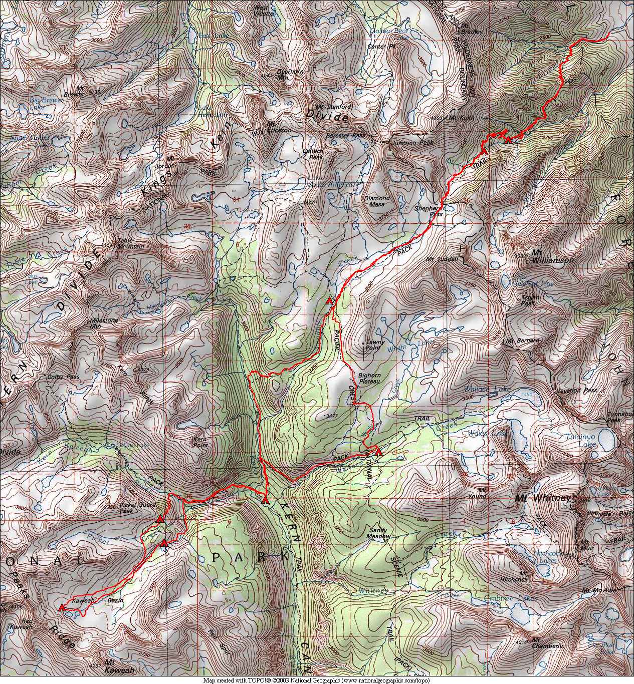
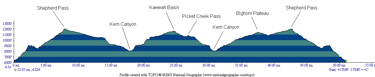
August 21 – Shepherd Pass Trailhead to Mahogany FlatAugust 22 – Mahogany Flat to Tyndall Creek
August 23 – Tyndall Creek to Junction Meadow
August 24 – Junction Meadow to lower Kaweah Basin
August 25 – Kaweah Basin ascent
August 26 – Kaweah Basin to Picket Creek
August 27 – Picket Creek to Wallace Creek
August 28 – Wallace Creek to Anvil Camp
August 29 – Anvil Camp to Shepherd Pass Trailhead
This was our third attempt to finally reach Kaweah Basin. The Kaweah Basin is nearly in the center of Sequoia National Park and is a good distance from the nearest trailheads in any direction (2-3 days at our comfort level). Past attempts were in 2003 when we climbed Mt. Kaweah but didn't go to the basin due to weather concerns, and in 2015 when we avoided going that far north due to smoke from a nearby fire. Finally 2020 was to be our year. Smoke was again a bit of an issue, primarily due to a large fire burning in the Golden Trout Wilderness just south of Sequoia National Park. Many days we had clear mornings with smoke arriving around noon and sticking around most of the rest of the day. Despite that, we still got some great views!
The weather was good, with only some thunder and sprinkles on the third day as we descended to Junction Meadow and then in camp with infrequent sprinkles all the way until early the next morning. Temperatures were unusually warm at the beginning of the trip, with some nights not getting below the mid 50's. Our first night in the car campground was still in the 80's at 10pm! Later in the trip we had some cold nights in the low 30's. Daytime temperatures were pleasant throughout the trip.
Animal encounters were few, mostly marmots in the basin west of Shepherd Pass (I call that area "marmot country"), and around Bighorn Plateau. Pikas were heard at many locations, but only briefly seen in upper Kaweah Basin (not enough time for a picture though!).
Go here to see all of the pictures with the same captions at Google Photos.