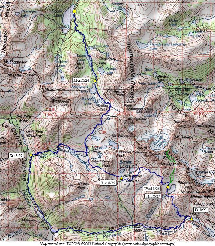
Mt. Sill and the Palisades 1998
August 24 – Timberline Tarns
August 25 – Bishop Pass and Knapsack Pass
August 26 – Potluck Pass
August 27 – Mt. Sill Summit
August 28 – Cirque Pass
August 29 – LeConte Canyon
August 30 – Bishop Pass back to the trailhead
Mount Sill is on the Sierra Crest, straddling Kings Canyon National Park and the John Muir Wilderness. It is 14,153 feet in elevation. Mt. Sill is reported to have one of the best views in the Sierra. This trip was originally planned to cross Scimitar Pass over the crest to the east of Mt. Sill and return via the Contact Pass and Big Pine Lakes. Upon seeing the south side (steep) and then the north side (snow-covered) of Scimitar Pass, we opted to instead try Cirque Pass, for which we didn’t have any information with us. Of course, we could only see the easy side of this pass when we made that decision. This was Ron and Steve’s first trip that included significant off-trail travel.
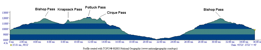
The trip included three off-trail passes: Knapsack, Potluck, and Cirque. A full-day climb of Mt. Sill from the large lake feeding Glacier Creek was included. After crossing Cirque Pass, we joined the John Muir / Pacific Crest Trail just below the lower Palisade Lake, and followed Palisade Creek to the Middle Fork of the Kings River, then up through Dusy Basin and over Bishop Pass. Total mileage not including the Mt. Sill summit was around 36 miles in 7 days. The starting and ending point of the trip was South Lake, off the end of Hwy. 168 west of Bishop, on the eastern slope of the Sierra.