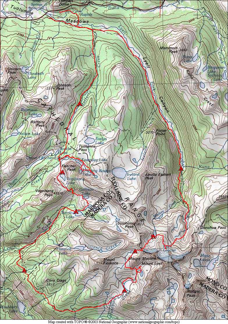
Lyell, Hutchings Creek, and Vogelsang 2018
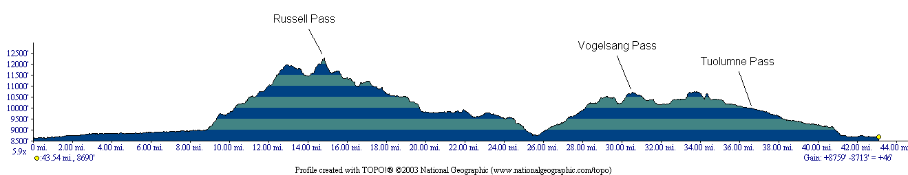
August 20 – Tuolumne Meadows to Upper Lyell CanyonAugust 21 – Upper Lyell Canyon to Maclure Lake
August 22 – Maclure Lake to Upper Hutchings Basin
August 23 – Descending Hutchings Creek
August 24 – Lower Hutchings to Cony Crags
August 26 – Bernice Lake to Vogelsang Lake
August 27 – Vogelsang Lake to Rafferty Creek
August 28 – Rafferty Creek to Tuolumne Meadows
The highest mountain in Yosemite National Park is Mt. Lyell at 13,120 feet elevation. Mt. Lyell used to have a large glacier hanging from its north face, but a few years ago the glacier was determined to be no longer moving, so it is now just a permanent snow field. The glacier on Mt. Maclure is likely in the same situation. Despite this, we visited these former glaciers on this trip, as well as crossing a challenging off-trail pass to the Merced River drainage and trekking through a little-visited valley before returning to Tuolumne Meadows via the Vogelsang area. Nearing the end of the trip we had some short days planned, but extended a bit with a trip behind Fletcher Lake to a high lake in the basin and then to Hanging Basket Lake, an interesting lake in a hanging bowl above the valley.
The weather was very nice on this trip, with no rain at all and few clouds. Some of the nights were cold, getting down to the mid-20's. And some nights there was gusty wind that continued all night, fairly rare in the Sierra in our experience. Smoke from some of the summer fires caused limited long range views some afternoons, but was not an issue otherwise.
We
had a few encounters with animals on this trip, including a couple of
bucks in Upper Lyell Canyon, pikas at the high camp in Hutchings Basin,
a bear at Bernice Lake, and a marmot at Vogelsang Lake.